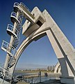
Category:Sluis- en Stuwcomplex Hagestein
Jump to navigation
Jump to search
| Object location | | View all coordinates using: OpenStreetMap |
|---|
Nederlands: Afbeeldingen van het Sluis- en Stuwcomplex Hagestein, Lekdijk 7, 4124 KB Hagestein. Gelegen in de rivier de Lek ter hoogte van het dorp Hagestein behorende tot gemeente Vijfheerenlanden, in de provincie Utrecht in het midden van Nederland. Het is een rijksmonument.
|
This is a category about rijksmonument number 532243
|
| Upload media | |||||
| Instance of | |||||
|---|---|---|---|---|---|
| Part of | |||||
| Location | Hagestein, Vijfheerenlanden, Utrecht, Netherlands | ||||
| Street address |
| ||||
| Located on street |
| ||||
| Architectural style | |||||
| Architect | |||||
| Owned by | |||||
| Heritage designation |
| ||||
| Inception |
| ||||
 | |||||
Media in category "Sluis- en Stuwcomplex Hagestein"
The following 68 files are in this category, out of 68 total.
-
Bouw stuw bij Hagestein voor Rijnkanalisatie, Bestanddeelnr 912-1662.jpg 3,912 × 2,640; 1.6 MB
-
Bouw stuw bij Hagestein voor Rijnkanalisatie, Bestanddeelnr 912-1663.jpg 3,912 × 2,676; 1.64 MB
-
Bouw stuw bij Hagestein voor Rijnkanalisatie, Bestanddeelnr 912-1664.jpg 3,882 × 2,676; 1.67 MB
-
Bouw stuw bij Hagestein voor Rijnkanalisatie, Bestanddeelnr 912-1665.jpg 3,822 × 2,673; 1.67 MB
-
Bouw stuw bij Hagestein voor Rijnkanalisatie, Bestanddeelnr 912-1666.jpg 2,634 × 3,864; 1.73 MB
-
Bouw stuw bij Hagestein voor Rijnkanalisatie, Bestanddeelnr 912-1667.jpg 2,676 × 3,846; 1.84 MB
-
Bouw stuw bij Hagestein voor Rijnkanalisatie, Bestanddeelnr 912-1668.jpg 3,882 × 2,646; 1.54 MB
-
Bouw stuw bij Hagestein voor Rijnkanalisatie, Bestanddeelnr 912-1669.jpg 3,888 × 2,658; 1.89 MB
-
Bouw stuwcomplex Lek-Hagestein, Bestanddeelnr 910-8286.jpg 4,138 × 3,304; 2.45 MB
-
Bouw stuwcomplex Lek-Hagestein, Bestanddeelnr 910-8287.jpg 4,062 × 3,304; 2.83 MB
-
Bouw stuwcomplex Lek-Hagestein, Bestanddeelnr 910-8288.jpg 4,084 × 3,304; 2.99 MB
-
Bouw stuwcomplex Lek-Hagestein, Bestanddeelnr 910-8289.jpg 4,121 × 3,304; 2.48 MB
-
Bouw stuwcomplex Lek-Hagestein, Bestanddeelnr 910-8290.jpg 4,139 × 3,304; 2.21 MB
-
Bouw stuwcomplex Lek-Hagestein, Bestanddeelnr 910-8291.jpg 4,128 × 3,304; 2.86 MB
-
Bouw stuwcomplex Lek-Hagestein, Bestanddeelnr 910-8292.jpg 4,141 × 3,304; 2.09 MB
-
Bouw stuwcomplex te Hagestein, Bestanddeelnr 909-5269.jpg 4,108 × 3,304; 3.09 MB
-
De stuw in de rivier de Lek bij Hagestein.jpg 4,770 × 3,177; 4.88 MB
-
De stuw van Hagestein bij hoog water - panoramio.jpg 1,792 × 1,184; 478 KB
-
De Stuw van Hagestein.jpg 2,048 × 1,364; 402 KB
-
De vistrap bij de stuw in Hagestein.jpg 4,770 × 3,177; 3.71 MB
-
De vizierschuiven staan open in de stuw bij Hagestein.jpg 4,770 × 3,177; 4.58 MB
-
Exterieur OVERZICHT - Hagestein - 20305219 - RCE.jpg 1,200 × 949; 207 KB
-
Hydro power in the River Rhine in Holland (9659091328).jpg 2,657 × 3,986; 752 KB
-
OVERZICHT - Hagestein - 20387095 - RCE.jpg 1,200 × 933; 225 KB
-
Overzicht stuwcomplex met schutsluis - Hagestein - 20357217 - RCE.jpg 1,200 × 821; 154 KB
-
Overzicht stuwcomplex met schutsluis - Hagestein - 20357221 - RCE.jpg 1,200 × 821; 167 KB
-
Overzicht stuwcomplex met schutsluis - Hagestein - 20357222 - RCE.jpg 956 × 1,200; 176 KB
-
Overzicht stuwcomplex met schutsluis - Hagestein - 20363338 - RCE.jpg 1,200 × 779; 163 KB
-
Overzicht stuwcomplex met schutsluis - Hagestein - 20363339 - RCE.jpg 1,200 × 792; 155 KB
-
P1070476 Stuw Hagestein.JPG 3,264 × 2,448; 3.62 MB
-
P1070477 Stuw van Hagestein.JPG 3,264 × 2,448; 3.54 MB
-
P1070479 Stuw van Hagestein.JPG 3,264 × 1,453; 1,018 KB
-
Sluis Hagestein 1.jpg 4,608 × 3,456; 4.05 MB
-
Sluis Hagestein 2.jpg 4,608 × 3,456; 3.39 MB
-
Sluis- en stuwcomplex Hagestein Stuw.JPG 2,832 × 2,128; 2.23 MB
-
Sluis- en stuwcomplex Hagestein Vispassage.JPG 2,832 × 2,128; 2.31 MB
-
SluisHagestein.jpg 5,395 × 3,596; 4.3 MB
-
Stuw bij Hagestein Geleide bogen met bovenop machinekame, Bestanddeelnr 912-4050.jpg 2,630 × 3,304; 1.62 MB
-
Stuw bij Hagestein, Bestanddeelnr 912-4044.jpg 4,204 × 3,304; 2.31 MB
-
Stuw bij Hagestein, Bestanddeelnr 912-4046.jpg 4,310 × 3,304; 2.29 MB
-
Stuw bij Hagestein, Bestanddeelnr 912-4047.jpg 4,143 × 3,304; 2.29 MB
-
Stuw bij Hagestein. Arbeiders verzwaren oever, Bestanddeelnr 912-4049.jpg 4,316 × 3,304; 2.34 MB
-
Stuw bij Hagestein. Sluizencomplex, Bestanddeelnr 912-4048.jpg 4,161 × 3,304; 2.23 MB
-
Stuw Hagestein 01.webm 20 s, 1,920 × 1,080; 59.8 MB
-
Stuw Hagestein 02.webm 17 s, 1,920 × 1,080; 23.61 MB
-
Stuw Hagestein.jpg 1,009 × 672; 219 KB
-
Stuw in de Lek bij Hagestein., Bestanddeelnr 072-0582.jpg 3,232 × 1,529; 690 KB
-
Vizierstuw in de Lek - Hagestein - 20387096 - RCE.jpg 1,200 × 956; 160 KB
-
Weir Hagestein 01.JPG 4,320 × 2,880; 3.62 MB
-
Weir Hagestein 02.JPG 4,320 × 2,880; 3.06 MB
-
Weir Hagestein 03.JPG 4,320 × 2,880; 3.46 MB
-
Weir Hagestein 04.JPG 4,065 × 2,710; 2.96 MB
-
Weir Hagestein 05.JPG 4,320 × 2,880; 3.67 MB
-
Weir Hagestein 06.JPG 4,320 × 2,880; 5.05 MB
-
Weir Hagestein 07.JPG 4,320 × 2,880; 5.2 MB
-
Weir Hagestein 08.JPG 4,215 × 2,810; 2.75 MB
-
Weir Hagestein 09.JPG 4,320 × 2,880; 3.93 MB
-
Weir Hagestein 10.JPG 4,145 × 2,764; 3.81 MB
-
Weir Hagestein 11.JPG 4,320 × 2,880; 5.21 MB
-
Weir Hagestein 12.JPG 4,320 × 2,880; 5.17 MB
-
Weir Hagestein 13.JPG 4,320 × 2,880; 4.96 MB
-
Weir Hagestein 14.JPG 4,112 × 2,741; 2.55 MB
-
Weir Hagestein 15.JPG 4,320 × 2,880; 5.16 MB
-
Weir Hagestein 16.JPG 4,320 × 2,880; 4.97 MB


